DISTRICT OF COLUMBIA / PROPERTY RESEARCH
See the parcel. Check the zoning. Resolve the unit relationship.
137,400 common-lot records, 73,545 separate condominium relationship records, and a sourced zoning review in one research pack.
$9 one time
Official DCGIS snapshots retrieved September 23, 2026. Source extract timestamps vary by record. Common-lot and condominium records overlap in purpose; do not add them together as distinct land parcels.
RESEARCH THAT SURFACES THE NEXT QUESTION
Two useful reviews, with evidence behind every flag.
Filter relationship questions or zoning review flags, then export matches with every original column. The same tool is included in your download and reads local files without uploading them.
Measured zoning coverage:
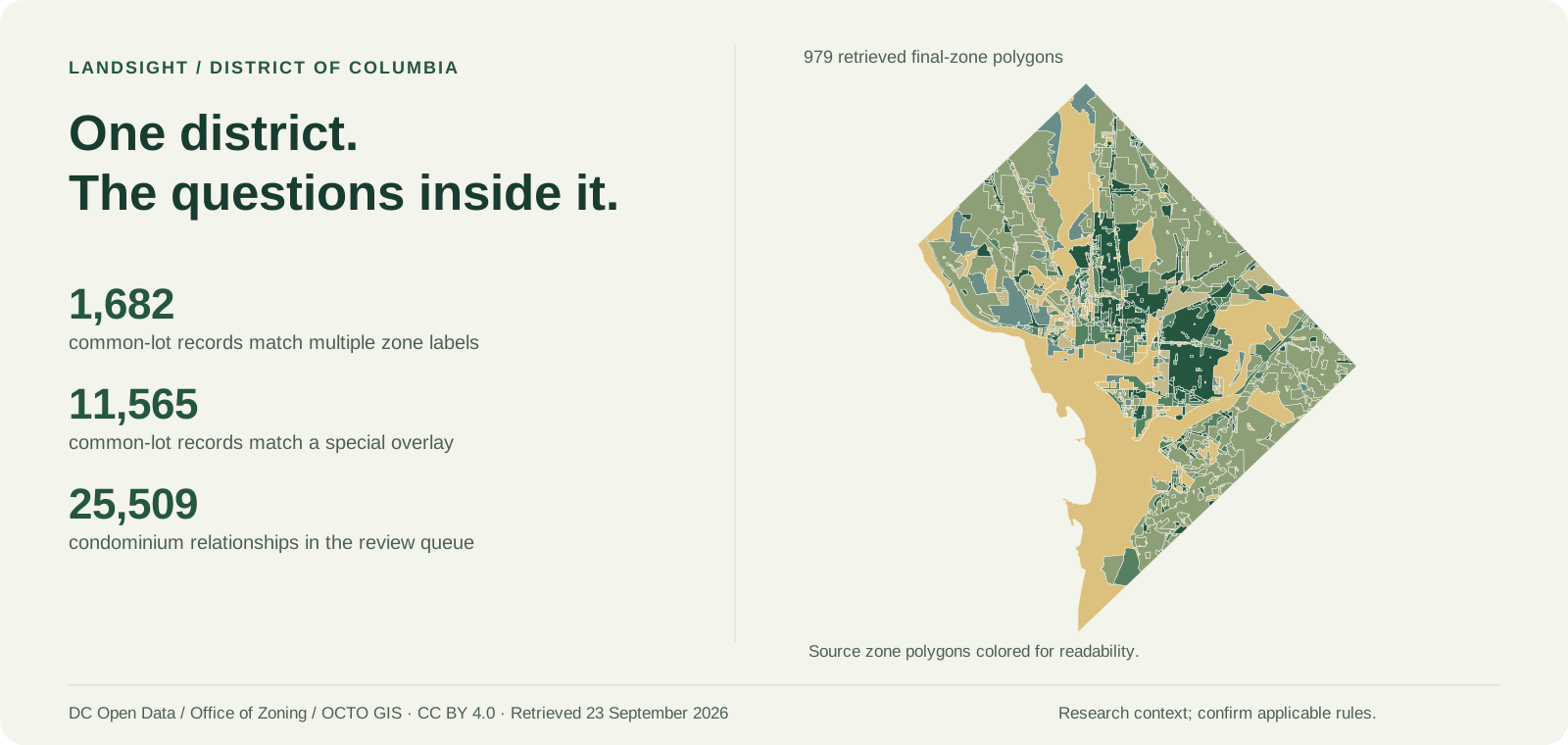
137,330 common-lot records match retrieved final zoning; 137,213 have at least 99.9% mapped coverage. 1,682 match more than one zone label; 11,565 match a separate overlay area. Review flags help you identify which rules and boundaries need attention.
The zoning CSV includes zone labels, inclusionary-zoning designations, overlay names, source links, coverage and original polygon IDs. Detailed evidence retains every matched source attribute. Based on 979 final-zone polygons and 23 separate overlay polygons. Pending zoning and case-specific PUD conditions are not included. Confirm project-specific permissions with the Office of Zoning.
Inspect the zoning review sample Zoning coverage and counts
Condominium relationships, made explicit.
All 73,545 condominium records match one exact tax-extract record. 25,509 need review because one or more relationships to assessment, common-lot or approval-lot records are not unique. Multiple matches may represent legitimate multi-lot regimes; a flag is not a finding of an error or title defect.
The pack includes the complete relationship file, a focused review queue, original source exports and the published DC join rules. Assessment attributes are attached only to unique exact matches. Parent-lot geometry is never presented as an individual unit boundary.
Inspect the condominium sample Relationship coverage and counts
CHECK THE BASE FILE
Recorded properties. Measured coverage.
132,965 recorded owner fields; 126,722 tax mailing address fields; 137,381 valid common-lot geometries. 137,265 have at least 99.9% FEMA mapping coverage; 1,506 intersect mapped SFHA.
Download the free parcel CSV sample View all coverage
| Original SSL | Recorded owner | Source site address | Mapped acres | SFHA overlap (%) |
|---|---|---|---|---|
| PAR 01550015 | SECOND NEW SAINT PAUL'S BAPTIST CHURCH | 2839 MILLS AVE NE WASHINGTON DC 20018 | 0.1727 | 0.0 |
| PAR 02060103 | FIELDS, VERNA | 3112 Q ST SE WASHINGTON DC 20020 | 0.1634 | 0.0 |
| PAR 01550228 | HARPER, CHARLES L | NE WASHINGTON DC 00000 | 0.0048 | 0.0 |
| PAR 00880026 | UNITED STATES OF AMERICA | QUACKENBOS ST NW WASHINGTON DC 20011 | 0.1838 | 0.0 |
| PAR 00870075 | FLORES, SANTOS F | 1385 MANCHESTER LN NW WASHINGTON DC 20011 | 0.1435 | 0.0 |
Source assessment fiscal year is not supplied. The current-year description and extract timestamp are retained separately. Tax mailing city/state/ZIP remains the original combined source field. Recorded owners and sale fields do not establish current title, market value, occupancy or sale availability.
Compare candidate parcels.
Try the shortlist tool with real samples
NWI wetland and water mapping: 740 common-lot records intersect mapped habitat; 137,324 have at least 99.9% digital project footprint coverage. NWI is biological mapping, not regulatory jurisdiction or proof that wetlands are absent.
The included browser tool filters the main parcel CSV by acreage and mapped constraints and exports original columns. Zoning and condominium reviews are separate CSVs with documented keys. No upload is required to use the parcel tool.
What you receive.
CSV and matching GeoJSON with 78 main parcel fields; 17 zoning-review fields; 28 condominium-review fields; relationship review queue; source exports; mapping evidence; samples; coverage reports; source metadata; and methodology. Original source keys and dates are retained, together with the retrieved DC parcel, zoning and related-table response archives.
Common ownership covers source lots outside right-of-way and does not represent individual condominium-unit boundaries. Invalid parcel geometry remains unknown for spatial analysis. Source area is square feet; mapped acres are calculated separately. Nearest school is contextual straight-line distance to a retrieved active physical public school, not attendance eligibility. No legal access, utility capacity, permitted use or project feasibility is established.
Read the methodology and field meanings | Inspect source provenance
ONE PAYMENT. YOUR FILES.
DC property research, ready to inspect.
Review the samples, coverage and dates before purchase. Delivery unlocks after confirmed payment.
one-time purchase
Available payment methods load below. PayPal and Bitcoin over Lightning are supported; the full ZIP unlocks after payment confirmation.
Your Lightning invoice
Awaiting paymentsats · $9 USD equivalent
$9 USD
PayPal checkout; available payment methods are shown by PayPal.
Continue to PayPalQuestions? dakota@landsightsolutions.com
Purchase terms & support
$9 USD paid once. Any applicable merchant tax appears at checkout. Internal business and client research are allowed. No recurring charge.
Underlying DC source data remain available under CC BY 4.0; LandSight's paid curation terms do not restrict those rights. Attribution: District of Columbia Office of Zoning, Department of Buildings, Office of the Surveyor, Office of Tax and Revenue, OCTO GIS and agencies named in source metadata. LandSight adds normalization, joins, measured screening and review queues. No government endorsement is implied.
If delivery fails its stated scope, request a correction or refund within seven days with your order ID at dakota@landsightsolutions.com.